Avalanche Hazard Information
Note: This Avalanche Hazard Information pertains to the 10th Mountain Division huts, the Grand Huts Association huts, and all of the privately owned huts. For important avalanche hazard information about the Alfred A. Braun Huts and the Friends’ Hut — which are located in areas of serious avalanche terrain, with recurring avalanche cycles — please link to their pages from The Huts menu and review all alerts and warnings.
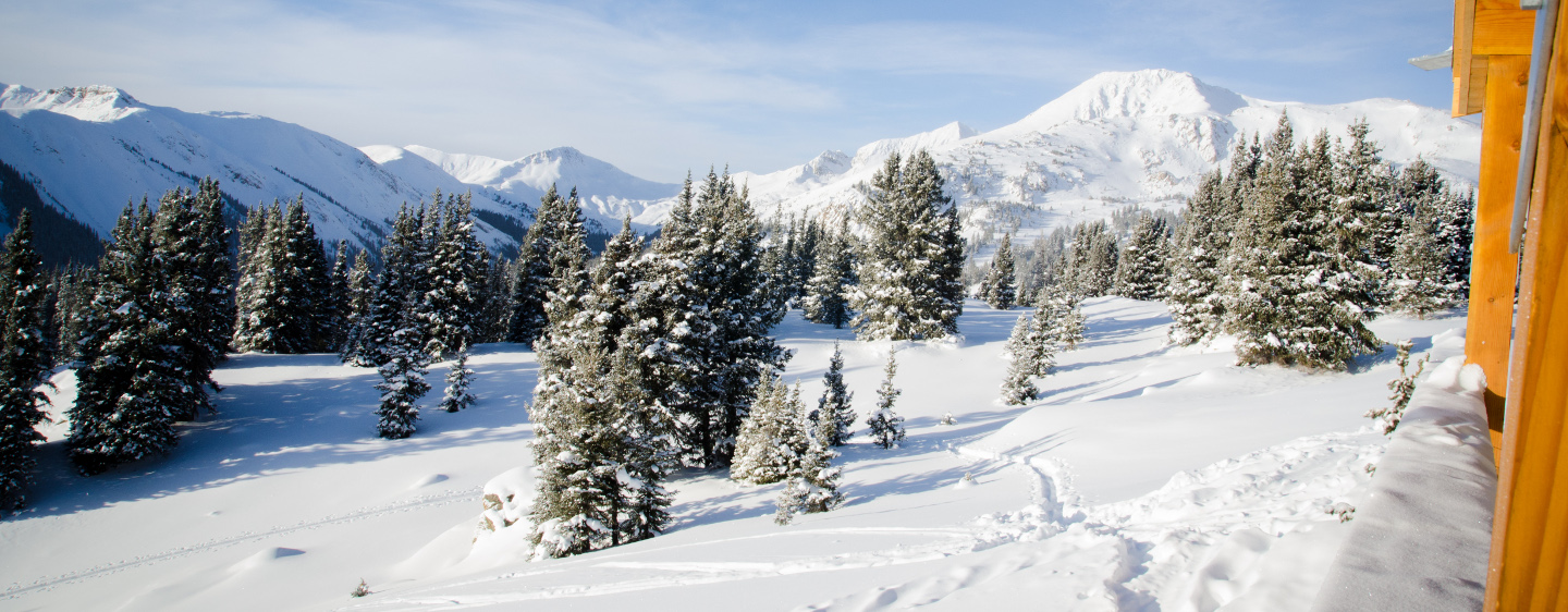
Colorado is known for its avalanche prone snowpack. A number of the suggested routes to 10th Mountain Division Huts pass through or are next to terrain that may be prone to avalanches. Accordingly, pick the suggested route that most suits your group and its abilities, carry appropriate equipment, and always exercise prudent backcountry travel techniques when passing through avalanche prone terrain. Remember, avalanches can occur in forested areas and can run into forested areas from open slopes. Moreover, a number of huts booked are situated in the midst of extreme avalanche terrain. Many other huts, while located in more modest terrain, still have access routes that cross avalanche paths.
We strongly suggest that someone in every group be experienced in evaluating avalanche and snow stability hazards and practicing prudent backcountry and winter mountain travel techniques. For up-to-date avalanche information for all of Colorado, visit the website for the Colorado Avalanche Information Center (CAIC).
We recommend that you start checking the Colorado Avalanche Information Center (CAIC) Website regularly before your trip to see how conditions are evolving. Study your maps to see what type of terrain you will be traveling through, and to see if there are alternative routes that might be feasible if snow stability conditions deteriorate. During most of the winter, travel to the huts — other than those in the Braun Hut System and the Friends’ Hut — is possible with a relatively minor degree of risk. However, if your trip falls within a period or cycle of high or extreme instability, your group is responsible for making the decision of whether or not to go — the huts are not closed for avalanche hazard reasons. While deep snow, bad weather, and white-out conditions are to be anticipated on any trip, a hut credit may potentially be issued for a trip to the 10th Mountain Division Huts, Grand Association Huts, or privately owned huts, if the trip is cancelled due to avalanche danger associated with an extreme avalanche cycle, where conditions are rated ‘Extreme’ or ‘Level 5’ on the CAIC’s danger scale.* To be considered for hut credit under these circumstances, please send us a detailed email to huts@huts.org, and we will reply as soon as possible.
*Note: For trips within the Alfred A. Braun Huts system and the Friends’ Hut, a special avalanche cancellation policy applies: groups with reservations in these huts may cancel on the scheduled day of their trip (or the next business day) if the avalanche danger is higher than what their group feels comfortable with, and receive 100% hut credit. Please see notice at the top of each of these respective hut pages for details.*
Information about avalanche activity along suggested routes that has been observed or reported by staff members, guides and hut users is recorded on this website. To review it, start by going to The Huts menu, select the appropriate hut page, scroll to that hut’s Trailheads/Routes section, select Winter, then select the dark blue Route Description button of the winter route you want to review. If avalanche activity has been reported on the route, you’ll see a warning note in orange, followed by details at the bottom of the route description about the location and rating of the observed or reported avalanche activity. If avalanche activity has not been observed or reported, this will also be noted, but does not indicate that avalanche activity could not occur in the future. Our avalanche activity records are location-based; we do not report observation dates or show repetition. We welcome new information — please send us an email to huts@huts.org, or call our reservation line, if you observe any avalanche activity during your trip.
Avalanche size/destructive force is based on SWAG-Snow, Weather and Avalanche Guidelines of the American Avalanche Association.
Size-Destructive Force
-
- D1 Relatively harmless to humans
- D2 Could bury or injure a person
- D3 Could bury a car, damage a truck, destroy a wood frame house, or break a few trees
- D4 Could destroy a railroad car, large truck, several buildings, or a substantial amount of forest.
- D5 Could gouge the landscape, largest snow avalanches known.
Emergency & Self Rescue
Backcountry hut trips can offer some of the most special outdoor recreation experiences of a lifetime. And the overwhelming majority of the time, they do – with most groups traveling to and from the huts safely and successfully.
But for that small percentage of trips that don’t go according to plan, the consequences can be extremely serious. These are two stories about 10th Mountain Division Huts hut trips that resulted in rescues.
When embarking on a hut trip, your group must be prepared and equipped for a bivouac, self-rescue, evacuation, or handling of other challenges and misfortunes that may be encountered in the backcountry. If a member of your group is injured or becomes ill at a hut or along the trail, or doesn’t make it to the hut, you cannot rely on immediate outside help.
About half of all search and rescue incidents within the hut system are searches for overdue skiers or snowshoers who get lost or underestimate travel time and don’t arrive at the hut as planned. Avoid mistakes that can lead to emergencies and a need for rescue.
Common pre-trip mistakes include:
- Not researching the route, weather or avalanche conditions.
- Not downloading .GPX files on your phone or GPS device in advance, so they can be accessed without service; not fully charging those devices; or not knowing how to use this information.
- Overestimating your group’s abilities.
- Not knowing what to do in case of accident or illness.
- Choosing an unreliable group communication plan, such as weak 2-way radios.
- Relying on a snowmobile to haul critical gear and food.
- Choosing to go on a hut trip with a known injury or illness.
- Not having a text-enabled satellite communication device, such as an InReach or newer cell phone, that can send and receive SOS messages via satellite in an emergency — or not knowing how to use it to communicate.
Common mistakes during the trip include:
- Getting a late start.
- Poor packing/equipment choices, such as overpacking of non-essential items that will weigh down one’s pack, and/or not bringing essential emergency gear.
- Underestimating travel time with packs and snow conditions, and the many factors of traveling as a group that can lead to slower rate of travel.
- Intentional separation among the group.
- Dead batteries in navigation and communication devices.
- Not establishing or following through on clear communication plans among your group.
The other half (more or less) of all search and rescue incidents within the hut system are injuries and altitude sickness. Several members of your party should be trained in first aid. Such training may be obtained by taking the requisite courses for an American Red Cross advanced first aid certification. Hut users who frequently travel in the backcountry should consider training beyond standard first aid. The CU Mountain Medicine Course is a good place to get this training.
For more information on trip planning and how to handle emergencies in the backcountry you can visit the Colorado Search & Rescue Associations blog, CSAR Blog. It has lots of great information on avoiding accidents and emergencies, and incident reports and reviews as well.
Contacting Search & Rescue
If the situation exceeds your group’s self-rescue capabilities, then contact the appropriate search and rescue organization by dialing 911 and requesting assistance. Keep these things in mind:
- Have the capability to contact the appropriate search and rescue organization with a text-enabled GPS device such as an InReach or newer cell phone with SOS messaging capabilities. Standard cell phone reception cannot be relied upon.
- Know how to send location coordinates to the search and rescue organization.
- Conserve battery and have a backup power source to recharge batteries.
- Any rescue effort will require time, and the group should be prepared to wait for several hours and handle the situation independently until search and rescue personnel are able to arrive.
- If a person is reporting an emergency on behalf of someone on a hut trip, they can call the Non-Emergency Dispatch of the county where the hut is located — see below for numbers.
- You will not be charged by the search and rescue organization for its response.
These county specific numbers are also provided on the confirmation email that is sent when a hut is reserved:
Eagle County: In An Emergency Call or Text 911
Eagle County: Non-Emergency Dispatch: Call 970-479-2201
To Help Support Vail Mountain Rescue Group please visit Vail Mountain Rescue Group
Huts In Eagle County:
Eiseman Hut
Fowler-Hilliard Hut
Harry Gates Hut
Jackal Hut
Peter Estin Hut
Polar Star Inn
Seipel Hut
Shrine Mountain Inn (Jay’s, Chuck’s & Walter’s Cabins)
Vance’s Cabin
Grand County: In An Emergency Call or Text 911
Grand County Non-Emergency Dispatch: Call 970-725-3311
To help support Grand County Search & Rescue please visit Grand County SAR
Huts In Grand County:
Broome Hut
High Lonesome Hut
Gunnison County: In An Emergency Call or Text 911
Gunnison County Non-Emergency Dispatch: Call 970-641-8200 x1
To support Crested Butte Search & Rescue please visit Crested Butte SAR
Huts In Gunnison County:
Friends’ Hut
Opa’s Taylor Hut
Lake County: In An Emergency Call 911
Lake County Non-Emergency Dispatch: Call 719-486-1249
To help support Lake County Search & Rescue please visit Lake County SAR
Huts In Lake County:
10th Mountain Division Hut
Continental Divide Cabin
Emmelyn Hut
Point Breeze Cabin
Sangree M. Froelicher Hut
Skinner Hut
Uncle Bud’s Hut
Pitkin County: In An Emergency Call or Text 911
Pitkin County Non-Emergency Dispatch: Call 970-920-5310
To help support Mountain Rescue Aspen please visit Mountain Rescue Aspen
Huts in Pitkin County:
Barnard Hut
Benedict Huts (Fritz & Fabi)
Betty Bear Hut
Goodwin-Greene Hut
Green Wilson Hut
Lindley Hut
Margy’s Hut
Markley Hut
McNamara Hut
Tagert Hut
Global Positioning System (GPS) Information
All GPS coordinates referenced below, and elsewhere on this site, were collected with the best available tools at our disposal. While we strive for accuracy in our data, discrepancies may still exist between our coordinates and coordinates you may take in the field.
10th Mountain advises against relying solely on a GPS for use in accessing the huts because they may not provide the desired accuracy due to weak satellite signals caused by forest cover, inclement weather, topography, less-than-ideal satellite positions, and other factors. If you are going to use GPS, we would suggest that your party have more than one unit to double check your coordinates, and that you also travel with a map, compass and altimeter for backup.
GPS and Smart Phones
As smart phones have become more powerful and their GPS capabilities have improved, more and more people are using them as a GPS instead of purchasing a separate, stand-alone device. When paired with a good mapping app, the increased screen size and resolution of most modern smart phones is big improvement over the smaller screens of many stand-alone GPS units. We recommend the Gaia GPS App for mapping on your smart phone, as it has a very intuitive interface and powerful trip planning tools. Gaia has provided an instructional hut-trip-planning video below that is packed with useful info. Gaia GPS also offers hut users a free 14-day trial of Gaia GPS Premium, so you can safely plan your next hut trip with Gaia GPS. The premium membership offers access to the full map catalog and the ability to download your maps for offline use, which is imperative for hut travel. Gaia GPS Premium Free 14-day trial and membership info.
The bottom line: a GPS unit can be a good tool for backcountry navigation when used in conjunction with a map, compass, altimeter and appropriate skills. If your GPS fails, you will be very thankful that you wisely brought your map, compass, and altimeter – and know how to use them. If you would like to know more about GPS accuracy and the different variables that can affect it, we have included links to some useful info at the bottom of the page.
Trailhead and Hut Locations
(GPS tracks for individual routes can be found on their respective hut pages)
NAD-27 Mapping Datum (PDF’s)
WGS-84 Mapping Datum (PDF’s)
GPS FAQ’s
Should I use my GPS to navigate to the hut?
10th Mountain advises against relying solely on a GPS for use in accessing the huts because they may not provide the desired accuracy due to weak satellite signals caused by forest cover, inclement weather, topography, less-than-ideal satellite positions, and other factors. A GPS unit can be a good tool for backcountry navigation when used in conjunction with a map, compass, altimeter and appropriate skills. If your GPS fails, you will be very thankful that you wisely brought your map, compass, and altimeter – and know how to use them.
What is a mapping datum?
A datum is a mathematical model of Earth which approximates the shape of the Earth and is used as a reference on maps. It enables calculations such as position and area to be carried out in a consistent and accurate manner, even though the Earth is not perfectly round, but rather is spheroid in shape. Every map has a map datum reference that is usually listed in the title block or legend of the map.
Why do I need to know about mapping datums and which one should I use?
When using a map and GPS together for navigation, your GPS must be set to the same datum as the map you are using. Failure to do so could result in errors of 200 meters or more in your displayed position. This is because the same position on Earth (a hut or trailhead, for example) will have different coordinates depending on the datum used to create the map. Most United States Geological Survey (USGS) topographic maps and ALL 10th Mountain Division Hut Association winter maps are referenced using NAD 27. Some newer USGS maps use NAD 83. If you are using your GPS without a map (and therefore going against the advising of 10th Mountain Huts!), using WGS84 is generally the best datum to use, as it is considered the most accurate datum to use with a GPS alone. Consult your GPS owner’s manual to learn how to set the correct datum to match your map’s datum.
Why are there two mapping datums?
Over the years, many different datums have been developed and used as references on maps all over the world. NAD27 (1927 North American Datum) and WGS84 (World Geodetic System 1984) are the two most predominantly used in North America today.
REMEMBER! When using a map AND GPS together, as you should be, BE SURE YOUR GPS IS SET TO THE SAME DATUM AS YOUR TOPO MAP! Failure to do so could result in errors of 200 meters or more in your displayed position. Consult your GPS owners manual to learn how to set the correct datum to match your map’s datum. Note that most GPS units come from the factory with WGS84 as the default map datum.
Additional Information and Links
GPS Systems and Accuracy
- Excellent article explaining the limits of GPS accuracy and what to look for in an accurate GPS unit.
- A more technical article explaining GPS accuracy and limitations and the formulas used to determine it.
- GPS.gov: The official government website for the GPS System
- Extensive overview of the GPS System.